|
10/26/2022 Topography, Geology, Weather & Water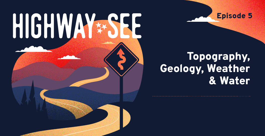
With so many roads to travel on throughout Tennessee, it’s rare that one would give much thought to consider what engineering marvels they actually are. Tennessee’s geography, topography, water and weather all vary from region to region, creating unique challenges to solve for as roads are built and maintained.
In this episode of Highway See, Chris ties all these puzzle pieces together to tell the story of how Tennessee’s roadway system came to be despite unique environmental factors:
Links
Transcript Chris: Welcome to Highway See, the podcast that explores the history of Tennessee’s road infrastructure, and why building better roads benefits us all. In past episodes, we’ve looked in depth at the origin and history of Tennessee’s roads—how they’ve developed from animal trails to foot paths to wagon trails to dusty gravel roads to the interstates we have today. And we have considered the impact of the various means we’ve used to travel on those paths and roads: from horseback, to bicycles, to stagecoaches, to the Model T, to the vast array of modern vehicles we now drive. Our roads give us not only commerce and connection, but freedom. Starting with the excitement of youth obtaining their driver’s license to the Great American Road Trip, driving has become synonymous with what it means to be free. Our roads are central to our very identity. Today we’ll examine some particular challenges of building these modern roads across our wide, beautiful state. As the crow flies, it’s more than 470 miles from Memphis on the western border to Mountain City at the easternmost point. However you’re driving on our roads, it’s about 540 miles across Tennessee. So, in Mountain City, Tennessee, you’re closer to Canada than Memphis. We’ll be looking deeper—literally—into Tennessee’s varied geology and the weather and water that shapes our terrain. From the flat, sandy ground in West Tennessee, over the rolling hills of Middle Tennessee, to mountainous, rocky East Tennessee, our state’s rugged and diverse topography does not easily bend to the will of humans and their roads. First, we’ll hear from Ed Wasserman. He’s a retired bridge engineer with the Tennessee Department of Transportation—that’s T-DOT. For 45 years, Ed worked at T-DOT and more than half that time, was the Civil Engineering Director of the Division of Structures. Ed explains the nature of Tennessee’s topography. Ed: In an engineering sense, if you start at the Mississippi River, you’re basically in a flat plane until you get to the Middle Tennessee area where you develop the hills, and the farther east you go, the higher the hills get until they become mountains. So, it's a vast change in the geology which impacts road construction and bridge construction as to what types of foundations are required, how much cut or fill is needed for a given roadway. Chris: Over Tennessee’s complex, varied terrain, add the continually changing, sometimes harsh weather patterns, and no road project is easy. We asked Bill Moore, Chairman of the Tennessee Infrastructure Alliance to pull from his vast T-DOT experience and talk a little more about the effect of weather on building our roads. Bill: In West Tennessee in the winter, of course, it starts raining in the fall and stops in the spring. And pretty much you just shut down construction in the mud in West Tennessee. In Middle and East Tennessee, you can continue to work in some of the areas of rock because it’s not affected as much by rain and the bad weather as it is when you don’t have any rock. So, some of the work in the eastern part of the state continues during the winter months. But pretty much you can’t pour concrete and you can’t lay asphalt when the temperature is really below about 40 degrees. Chris: David Donoho, director of construction at T-DOT from 1998 to 2008, dove a little deeper and really broke down how cold and rain affect roadbuilding. David: From the construction standpoint, of course, weather affects, you know, how you build the project. And it depends on which stage you’re in, depends on what area of the state you’re in. If you’re in a very rocky area, the weather won’t tend to prohibit the construction of the project; it’ll move on if you’re building on rock. If you’re in predominantly an area that is built with clay-type soils, the weather would prohibit you from work and so you—actually, when T-DOT will look at a project, they have to determine the length of time that takes to build it based on where they are, the number of winter seasons they go through because that actually would slow the project down. And T-DOT would determine the number of days they think for each one, how the weather will affect it as they go along. Different things like grading, building the embankments, doing the cuts are weather dependent. Other things like bridges aren’t as weather dependent because the weather doesn’t affect that part as much. So, you can work in the rain a lot of time, building bridges, whereas you cannot do that when you’re moving dirt. Chris: So, it’s not only a matter of how much rain, but where the rain is happening and what type of project is being worked on. He goes on to tell us more. David: Say the rain or extreme weather would get to the point where any rain is going to make you shut construction down. And as mentioned, if you’re working rock, you can work up to a point where the rain itself will be the deterrent. It’s not the material you’re working with; it’s just the rain itself. But if you’re moving dirt and it gets too wet, you’re just basically wasting time in trying to compact it because you’re basically trying to compact mud. There’s optimum moisture content when you’re putting the material down that it needs to be, so you’d have to make sure they don’t exceed that. Like I said, the bridge is not as weather dependent. There are some temperature extremes. Concrete has to be placed when it’s above 40 degrees. You do not want that concrete freezing while it’s curing, and measures have to be taken into account if you think the weather is going to get cold. Chris: Obviously David understands the science of roadbuilding at a molecular level. But he’s happy to make it simple for the rest of us as he continues explaining the temperature sensitivity of asphalt. David: When you get into the paving, paving’s also limited based on weather. One of the analogies I use with kids is that asphalt is more like Rice Krispie treats. You take the Rice Krispies, you melt the marshmallows, you mix it together, and as it cools, the marshmallows will set and that’s the asphalt liquid inside the rock aggregate. When you’re laying asphalt—you might not know this—asphalt leaves the plant at about 300 degrees Fahrenheit. That’s the mixing temperature. And it’s then transported out on the project site with the trucks. And you do not want to get much heat loss when you’re coming out there. So, generally, when you get out on the project site you would hope to be around 240, 250 degrees. It will then run through the paving machine and come out behind the paving spreader and they will roll the pavement to densify the pavement and make sure that there’s no rutting and it’s smooth pavement. And probably around 180 degrees is where you get to the point where you will get no more compaction effort on the asphalt. So, you have to be sure that you got to hit it between that 180 and 250 degree temperature to make sure that it’s compacted correctly. Chris: The topography and geology in Tennessee vary dramatically. From the flat west and rolling middle to the plateau area and mountainous east, our state has some major differences in terrain. As Paul Degges, who served as Chief Engineer at TDOT for 18 years from 2004 to 2022, explains. The Sequatchie Valley and the Tennessee Valley are two of the major geological features of the state. And between those two valleys, we have a large ridge where we have a plateau up on top. And they have what you call a talus slope where for the last three or four million years at least, material has been falling off these bluffs into the Sequatchie Valley. And State Route 30 travels across that. That material that the road is built through not solid rock. It is the debris field, so all of that material is not just one solid slab of rock. If you can imagine, in the western part of the state, there is no rock and so we build roads on top of mud. Chris: We commonly think of Tennessee as the three Grand Divisions of West Tennessee, Middle Tennessee, and East Tennessee, and that’s why there are three stars on the Tennessee state flag. But geologically speaking, Tennessee is divided many more ways. Paul: Tennessee has basically seven physiographic zones and they’re all unique. From an engineering standpoint, we have to bring a different set of tools to the table to build roads in those different areas. You have the Unaka Mountains in East Tennessee—that’s the Appalachian Mountain chains—you’ve got the Tennessee River Valley, Then you got the Cumberland Plateau and the Sequatchie Valley, you have the Highland Rim around Nashville, the Central Basin of Nashville. If you look on a topographic map of the state, Nashville’s kind of in a basin surrounded by hills. And then you start going out in West Tennessee and you get to the West Tennessee Alluvial Plain out there, and then the Mississippi River Delta and Floodplain right at the river. Chris: Because of those vast differences, topography, geology, and weather patterns can wreak havoc on planning roads and construction efforts. To put it simply, the form of the Earth in Tennessee itself has a say in the way we build roads. In a state with topography ranging from sandy to rocky and everything in between, the geology has to be factored into all construction efforts. In terms of roadbuilding, we call this ‘geotechnical engineering.’ Harry Moore is a retired T-DOT geotechnical engineer. So, what does that mean exactly? First, Harry will explain the general functions of the geotechnical engineering office. Harry: We were responsible for investigating new roadways, new bridge foundations, and any type of landslide, rockfall repair project or sinkhole project. And we use our drilling people to get subsurface information for us, then we would take that information and compile a report of our findings and recommendations for whatever particular project it happened to be. Sometimes the projects were like five-mile long roadway alignments, so we would do the whole project, the whole five miles drilling and sampling and mapping the geology and soil information, and then take all that data and have lab analysis done. And we’d put all of this into a written report that would then go to the design office. And their roadway designers would take our information and apply it to the road design for that particular project. Chris: Next, he describes their responsibility in bridge building and general maintenance of existing roads. Harry: The same would apply for bridge foundations and retaining walls. We would get, in a particular road project, there might be five new bridges that have to be built, and they would ask us to do the foundation investigation for all of those bridges. So, we would investigate it, map it, do the core drilling, have the analysis done in the lab, and then compile a foundation report for whatever particular structure it happened to be, whether it was a bridge or a retaining wall. So, those were the main aspects of our office. Now, we also were involved in the construction of the projects and the maintenance after the job was completely built and went to use by the general public. Then the maintenance people, they have to maintain these roads, and if they had some type of geologic issue, then they would call us and ask us for our recommendations on how to fix it. Most of the time, these were sinkhole-related problems, or landslide, or rockfall related problems. Those are the three big geotechnical issues that we dealt with with the maintenance office. Chris: The geotechnical engineers also help on new or prospective projects. Harry: And, on a lesser part, we would be involved in the study of new highway locations and we would have input. We’d go look at a map and they’d say, “Tell us if there’s any major issues here.” So, we would go out, study the geology, sometimes do drilling, but not very often, and then we would say, “Yes, this is a good place to build a road,” or, “No, you need to move it if you’re going to proceed with it to miss the geologic hazard.” Our goal in the early stages is to identify geologic hazards like landslide problems, unstable areas, sinkhole areas. And we got into studying acid-producing rock; where rock that was excavated, we had to analyze and study if that particular type of rock was going to generate acid runoff or acid drainage if we used it in the roadway. That was a big environmental issue that we became heavily involved in. Chris: Obviously, geotechnical engineering is incredibly important in a state like ours with so much different terrain. Chris: Now, let’s hit the brakes and take a little detour to understand acid rock. In this case we aren’t talking about a subset of music but actual rocks that may be encountered when cutting a path through the earth, for a road in this case. When broken up and brought into contact with rain or ground water and air, particular components of certain rocks can break down and produce acid. For example, if sulfides are present, the breakdown may produce a sulfuric acid. The water may then carry those acids over or through other rocks or earth containing heavy toxic metals, and the negative effect increases as those substances are leached from their previously inert state and flow into streams, rivers, and the water table. Paul Degges explains how this situation must be dealt with in road construction. Paul: Once you come in and cut that material out, when it’s exposed to the air and water, it creates an environmental problem that pollutes the waters of Tennessee and makes it difficult for aquatic creatures to survive. So, we have to build, basically landfills, clay-lined landfills for all of the material that we pull out of that project, and we have to bury it in these landfills that have clay and geo-textile liners. And then we have to monitor those in perpetuity. So, it can be tremendously expensive. And the Cumberland Plateau from north to south has a lot of the acid-producing rock and that can really drive your cost of construction. Chris: Now, we’ll continue on our journey across Tennessee to take a closer look at the conditions and challenges specific to each grand division of Tennessee. We’ll start in West Tennessee with David Donoho. So, you understand David’s point of reference, keep in mind that the Tennessee River starts in Knoxville in East Tennessee and flows southwest into Alabama. Then, it flows west across the width of upper Alabama. The Tennessee River then quickly turns practically due north and crosses the entire state of Tennessee flowing north into Kentucky and eventually the Ohio River. Where the Tennessee River crosses the state from the southern border to the northern border, it provides the boundary between West and Middle Tennessee. And, in West Tennessee, rock gets much harder to find. David: It’s very unique the way that Tennessee geologic areas are. Basically if you go down ten feet, you’re hitting rock. Once you cross the Tennessee river, it gets to a point where you do not hit rock. It’s all silty sandy material. Chris: The challenge of road-building in West Tennessee is more clear as David compares it to Middle and East Tennessee. David: In Middle Tennessee and East Tennessee, all the bridges are either built on piling. And in the Middle Tennessee, East Tennessee area, the piles are driven, the piles will hit rock, and that’s called the bearing. So, that’s where you get refusal for the pile and you actually got a foundation to build off of from that driven pile. When you get into the West Tennessee area, you do not have the rock for the pile to have a point bearing on. When you think about trying to drive a stake in the ground and the farther you drive the stake the harder it gets to drive—it builds up friction. And so, that’s basically how the piles are used in West Tennessee is that they’re driven to a point where there’s so much friction on the piles, they actually support the load. Chris: Paul Degges describes further challenges of building roads in West Tennessee because of the specific source and makeup of the land there. Paul: One of the peculiar things about West Tennessee is the material in West Tennessee is blown from the Plains of the West, and so it has a very small particle size, a very fine-grain material. And it’s interesting; it can sit flat and actually it can set vertical pretty well. But if it’s on a slope and it rains, it gullies out and makes a big, big mess. West Tennessee is a particular challenge. Back in the early-20th century when agricultural equipment got pretty big, they started ditching a lot of those rivers out right there. And so, now you have what we call it an incised channel, but most people look at it and say instead of a squiggly river it’s just a big ditch. And so, they dig down and they’re very deep. And so, where we had a structure that might’ve been built in the twenties or thirties, if the stream has degraded, we have a waterfall underneath those bridges. And so, a lot of the work that we’ve had to do in West Tennessee is to deal with those fine grain soils that get washed out so easily in storms. And we work with the drainage authorities in West Tennessee and the Department of Environment Conservation and the Corps of Engineers to try to find ways to stabilize some of those streams to where they’re not wreaking havoc and washing roads out. Chris: Well, it sounds like all the water we have in Tennessee could really cause us problems, especially when building and maintaining our roads. So, we asked Paul to tell us more. Paul: So, if you had a river that was three miles long and it was real, real curvy, and you just dug it as a straight ditch and now it’s only a mile long, the water moves a whole lot faster and so it picks up all of the soil material and it digs a big hole. Because that energy by moving that dirt in it’s one of the troubles we ran into in trying to over-engineer nature. I mean like the old adage goes, “History shows us again and again how Mother Nature shows the folly of men.” And so, we got to be careful that our engineered solutions have to work with our environment. If we try to over-engineer things, you end up with Godzilla. Chris: Just to be clear there have been no Godzilla sightings in Tennessee. Yet. But roadbuilders have found evidence of other kinds of animals, specifically the prehistoric kind. As it turns out, Tennessee’s geology is also filled with fossils. We’ll have a lot more to uncover about that in a future episode. Chris: Okay, now that we’ve talked about the challenges of highway construction in the flat west, let’s take a look at Middle Tennessee. Heading east, the elevation slowly increases. Open plains change to rolling hills with rock outcroppings, even rock formations and cliffs. Harry Moore, our resident geotechnical engineer explains. Harry: Predominantly, Middle Tennessee is underlain by flat-lying to gently folded sedimentary rock. Most of that rock is classified as a limestone. There’s different varieties of limestone from silica stone to—I don’t want to get real technical, but things that we call micrite and sparite—but there are different types of limestones. And some of them are very fossiliferous from shells of ancient sea animals. And the structure of Middle Tennessee is a big dome. We call it the Nashville Dome, structurally, where when we get real heavy into the historical past, during the formation of a supercontinent called Pangea, when what we call North America today collided with South America and Africa, it formed this huge continent that we refer to as Pangea. That occurred roughly 230 million years ago—the end of that episode did. Well, when these continents all came together, the rock material to the west of the actual collision boundary flexed up a little bit. They weren’t broken and shoved on top of each other; they were flexed, so it formed this huge arch of rock structure. And you can imagine this huge arch that’s several miles high and gosh, I don’t know, 150 miles across. It fractured; it broke. The rocks fractured and cracked right along the crest of that big arch or dome. It’s like you took a board and you grabbed each end of it and you pushed each end down. The board is going to break in the middle at the high point. Well, the rocks do the same thing. They broke, they fractured, and because of that, they weather a whole lot quicker there. And over the last 200 million years, that weathering has produced a basin that we call the Central Basin. That we have a structural geologic dome and a topographic basin in the same area that we call Middle Tennessee. And because the limestone—most of that area is limestone—it weathers to different thicknesses of soil based on what the limestone content was. Chris: Now that we have a deeper context of the geology in Middle Tennessee, it begs the question, what does all that mean for road construction? Well, as Harry explained, much of the central state area is made of limestone and an interesting fact about limestone is that water can actually eat through limestone, causing it to collapse in on itself or sometimes into an underground cave or river below it. Once that happens, the clay or soil on top of the limestone will collapse under its own weight, and then you have a sinkhole or, in a mountainous region, a landslide. Which, and I don’t have to tell you, can be pretty catastrophic for a road. Chris: In East Tennessee the rocky hills and mountains create significant challenges for building roads and just getting from place to place. Paul Degges gets into the details about it. Paul: But, typically it can cost two, three times more in East Tennessee to build roads than it does in West Tennessee. Just as an example, in Granger County, Tennessee, back in the nineties, we built a project on U.S. 25 E—it’s, the same road that goes through the Cumberland Gap Tunnel—and the rock that we cut there is acid-producing and it had a very low pH, and about 60% of the cost of that project was addressing the acid-producing rock. Chris: The hills, rocks, and mountains of East Tennessee really affect where the road can be, and it often meant those early roads especially could not take a direct path. Here’s Jason Mumpower, Tennessee Comptroller and a native and resident of Upper East Tennessee. Jason: I’m Jason Mumpower. I currently serve as the comptroller for the state of Tennessee. Prior to that, I was very honored to serve as State Representative for Sullivan and Johnson counties, right up in the corner of Upper East Tennessee. I served as State Representative for those communities for fourteen years, from 1996 to 2010. Well, when I was in the house of representatives, I represented a third of Sullivan County, which is one of the largest counties in Tennessee, and I also represented all of Johnson County, Tennessee. Johnson County is up in the very Eastern tip of Tennessee. It borders Virginia and North Carolina, and the County seat of Johnson County is Mountain City. Now, it was unique to have the perspective of representing a large county with a lot of infrastructure in the community, and then also representing Johnson County and Mountain City, which were much smaller and definitely not as developed. You know, I can remember During one of my first campaign stops in Mountain City, somebody there told me a story, a story that resonated with me, still resonates with me today. They were hearkening back a few years and I was campaigning there kind of near the courthouse in the middle of Mountain City. And they said, “Jason, you know, it was a few years ago that”—I think they said Governor Clement was up here—“And he was standing on the steps of this very courthouse. And we had a large crowd assembled, and he stood on those steps and he said, ‘You know what? Citizens of Johnson County, citizens of Mountain City, the next time I’m here, I’ll drive in on a four-lane highway.’” And of course, the crowd cheered and there was great adulation and joy throughout the community. And they went away thinking that the governor had promised them a four-lane highway. Of course, what they didn’t realize is that once the governor got back in the car, his staff turned around and said, “Governor, are you crazy? What have you said? We can’t build a four-lane highway to Johnson County.” He said, “The next time I’m back, I’ll drive in on a four-lane highway, and what you didn’t understand: I’m not coming back. It’s too hard to get here.” And so, you know, that story; I don’t know if that’s a true story or a tall tale, but the message is the same either way. And that is, that the people of Johnson County and Mountain City understand they need a road to get in and out. You know, there are at least three ways to get to Mountain City if you’re coming from another part of Tennessee. You have, first, Highway 421, which runs from Bristol to Mountain City. And you go over a road—a twenty-mile road—which is nicknamed The Snake, it is so curvy. It is a road that’s very popular today with motorcyclists. They like to go over there and ride those hairpin curves and travel through Shady Valley, Bristol over one curvy mountain into Shady Valley, over another curvy mountain into Mountain City, then takes you into North Carolina. Or you can, if you don’t want to travel The Snake, you can travel Highway 67 from Carter County up into Mountain City, but it also goes around Watauga Lake and is a very curvy road, a very curvy two lane road. Or, if you want the most direct route into Mountain City, if you want the route that really has to be taken by truckers there for deliveries or any kind of business work in Mountain City, you really have to take the road to Damascus. And no, I’m not talking about that great road of old where Saul was turned into Paul, not that Road to Damascus. I’m talking about the road to Damascus, Virginia. The easiest way to get to Mountain City is actually to go up I-81, nineteen miles into Virginia, and then take Exit 19 off I-81 and cut down on a road that takes you through the town of Damascus, Virginia, Then into Johnson County, then into Mountain City. And you know, it’s remarkable that, particularly for truckers or people looking to do business and commerce in the town of Mountain City, that you have to go nineteen miles into another state to get there. Chris: Because of our topography, when it comes to building through certain regions, engineers sometimes have to pivot when they are met with obstacles. Part of Harry Moore’s role, a major part of it in fact, would be to assess these obstacles, diagnose the problem, and prescribe a solution, whether they were found out before or during road construction. Harry explained. Harry: If there were sinkhole problems in the area prior to construction and we identified them and we had made recommendations on how to treat the area prior to placing the final road in that area, the construction office would call us to come out and guide them through that. And another, probably the biggest role that we had was if during construction they encountered a stability problem, then they would call us to come out and study it and then advise them or recommend what they should do to correct it while it was still in the construction phase. And that would involve a little cut-slope landslides, sometimes it was a big rock cut that they were excavating and the whole thing started crumbling, or new sinkholes might form in the road bed, or something like that. And that’s what we had to deal with during the construction. Sometimes it was acid-producing rock that they got into, and if we knew that there were going to be problems with it, well it was probably put in the plans as to what to do and how to identify it. And we always would respond to their request to come out and help them do that. That’s mainly what we did during the construction phase. And we worked hand in hand with all the construction personnel, from the regional construction engineer and the project engineer to helping the inspectors. And all of that was coordinated with the contractors. It was quite often that they’d be excavating for a bridge foundation and then they’d run into a big problem that we weren’t expecting and we had to deal with that. Chris: With so many different geological and topographical situations and surprises, the costs of roads and materials used can vary widely. Paul Degges explains. Paul: The real big thing that we’re trying to do in the highway construction profession is to try to deliver something that is cost effective. And so, in the United States, tunnels really weren’t the bailiwick or the go-to for dealing with adverse topography. So, mainly it was big, large cuts. And so, we would do a lot of geological investigation, core drilling into the earth, and then coming in, do we do vertical rock cuts? Do we lay the slope back? Do we build retaining walls? In general when you’re designing a road, in some areas, you’re going to have to cut material. In some areas, you’re going to have to borrow material to fill a hole in. And so, the highway designer is trying to use this concept of a balanced project. You don’t want to remove so much material you got to go find some hollow somewhere to fill it all in. Environmentally, that’s not very sustainable. But the reality is from a cost standpoint, if you’re moving material just to get rid of it, that costs a lot of money. And you think about all of the fossil fuel that takes, the diesel, to run all the heavy equipment, to mine the material, to put it in a big old dump truck, to haul it, dump it, then you have to have another piece of equipment to spread it and make sure it’s stable where it’s at, so this idea of balancing the cuts and fills on a project is very critical in the highway construction industry. As I mentioned, we typically haven’t done many tunnels in Tennessee. Tennessee, from a highway standpoint, there’s only about seven highway tunnels in Tennessee. Chris: Fun fact: in Upper East Tennessee, near Shady Valley on Highway 133, two miles south of the Virginia-Tennessee state line, you’ll find the world’s shortest tunnel. It’s a passage through the rock in what is now the Cherokee National Forest called Backbone Rock. It’s eighty feet tall but only 20 feet long. In 1901, the Tennessee Lumber Company blasted through the rock to create a more direct path for hauling timber by rail to the nearest city. It later became a lumber road for trucks, and eventually State Highway 133. Paul: Most of the tunnels on the state highway network—and the local road network—are in the Chattanooga area: Missionary Ridge, and the Bachman Tubes, and such, in Chattanooga. So, we do have a few tunnels, but historically our go-to for highway construction has been cuts, where we do a cut in the rock, take that material and turn around and use that material for fill to where we’ve balanced the cuts and the fills on a project. Chris: And really, that’s the trick of it all, trying to balance the need for roads and efficiency and financial limitations with the challenges presented by the Earth’s very shape. But if nature threatens the integrity of a proposed road or throws a curve ball threatening the safety of drivers, T-DOT is ready to put in the extra labor and money to get the job done right. That’s why projects across Tennessee are assessed, planned, and constructed in many different ways. Here’s Paul Degges again. Paul: The cost for construction can be dramatically different in various parts of the state. So, certainly in West Tennessee where it’s relatively flat, it can be relatively cheap in general. However, if you’re going through a real poor soil area, you might have to excavate a lot of material and put a much thicker road bed in. We struggle in the western part of the state in that the aggregate conditions, there’s no limestone, there’s no granite there, so the type of material we build roads with doesn’t have the longevity of some of those harder stones that we get in Middle and East Tennessee. Chris: In addition to the plains, hills, curves and mountains, Tennessee is covered with a lot of water. It has created challenges in building roads around and over it, and until less than a century ago, periodic widespread flooding was sometimes catastrophic. That’s what prompted the 1933 Tennessee Valley Authority Act, a large portion of President FDR’s New Deal, meant to oversee the construction of dams to control flooding, improve navigation, and create cheap electric power in the Tennessee Valley Basin. And it did all that and more, as Paul explains. Paul: The work that FDR did in a lot of the public works areas to start getting things moving back again. Through the Tennessee Valley Authority Act in 1933 and those types of projects, they were able to really address some of the real transportation needs that were impacted by all this water we have in Tennessee that would—you know, in East Tennessee every winter, all the roads and bridges would get washed out during big floods. And controlling some of the flooding through the work that the Tennessee Valley Authority did was important. A lot of the roads on the state highway network today were actually built by the TVA Act because if you built a dam and flooded these big lakes, you had to relocate the roads. And you couldn’t even get the equipment in to build. For instance, Norris Dam, they had to build a road to build the dam. And of course now we have U.S. 25 up through there is one of the roads that was accessing the ability to build the dam and have good roads through there. Chris: The dams throughout Tennessee have made a dramatic difference in flood control, but it certainly still happens locally, though on a much smaller-scale. In addition to flooding, roads can be affected by other water-related problems, like landslides, washouts, and potholes. I’m sure you’re very familiar with potholes and the jarring problem they can be. But do you know how potholes are formed? What do they have to do with water? We asked Paul to explain. Paul: It’s very similar to the roof on your house. So, water is the damage. It’s what tears the roads up. So, if you get a little bitty crack, water gets down in it then you run a big old, heavy tire over it and it squishes it down. Then maybe it might freeze that night. That water expands when it freezes and it will just start easily—it just works that material. If you’ve ever taken an aluminum can and just bent it back and forth, eventually it’ll tear up. And that’s the same thing goes on with the road. The water gets down in there. You get the wheel traffic over and over and over. It loads it and then unloads it, loads it and unloads it. It’s just like that aluminum can. And ultimately that’ll get a pothole. Chris: Water takes many forms and they all have an effect on our roads and travel. As we just learned, the liquid water seeping in cracks and freezing solid, thawing, and refreezing leads to potholes. As vapor, it can make the air heavy and magnify temperatures. Sometimes, it can seem to materialize and reduce visibility or even become a wall, a wall of fog. The combination of Tennessee’s topography, many bodies of water, soil composition, plant life, and weather patterns make high humidity and fog very common. A horrific example of this reality is the 99-car pile up that happened on December 11, 1990. There was an incredibly foggy stretch of Interstate 75 near Calhoun, Tennessee, that reduced visibility to zero and resulted in 42 injuries and 12 fatalities. Bill Moore remembers the tragedy. Bill: They just kept running in there, crash, crash, crash, crash, crash, and people got out of their cars and some of them got run over by other vehicles and whatnot. And, of course, if you stayed in your car you were your suspect to get hit. And when you’re driving down the road and everything’s clear, and all of a sudden, you just go in this fog zone. And it was so dense that you couldn’t see the car in front you. Some people would slow down, and others wouldn’t slow down. Of course, the ones going fast would hit the ones in the rear. Chris: The 99-car pileup is one of the worst events in Tennessee’s motoring history, but it led to the installation of new technology to help prevent such catastrophe in the future. Paul describes it. Paul: It was caused by fog. So, we implemented one of the very first intelligent transportation systems in the country through there that has automated equipment that closes all the ramps to the interstate. It has LED lights that pace at a different speed. So, if you’re driving down the road, you will have these lights, that pace that you can follow to slow down. And it’s a pretty cool technology through there. Fog can be a whiteout condition. Chris: Thankfully the engineers and road professionals throughout Tennessee don’t let nature’s tenacity stop them from building better roads or finding solutions to help keep drivers safe. Chris: It’s only fitting to close this episode of Highway See with a Great American Road Trip story, starring Tennessee’s topography and quickly changing weather. When this adventure on the road took place, Raul Lopez, now a long-time Tennessean, had recently moved to Nashville from Florida, and he was not yet familiar with how much where you are driving on Tennessee’s topography can matter during a time of year the weather might get very cold and be unpredictable. Raul will travel from Nashville to Knoxville for the first time, intending to return that same day. Here’s Raul Lopez to share his Great American Road Trip adventure. Raul: I was very excited. I’ve never even been to Knoxville, so that was my first trip. And I left really early cause I’m coming from Nashville. And it was a beautiful, cold day driving there. Chris: But while Raul was at an event in Knoxville, the weather began to change, as it often does in Tennessee. Raul: It was still early afternoo-nish. And then we walk out, and all of a sudden it was like snowing. I had no idea that it was going to snow that day. Back in that day, we didn’t have apps or 24/7 weather, nor did I know about the famous Cumberland Plateau. Even though I drove over in the morning, I didn’t realize what could happen. So anyway, so I got in the car and said, “No, I’m going to go home,” so, I went on the road, and the snow just started coming down and it just kept going. And then it started getting really, really cold. As the traffic flows slowed down just before the Cumberland Plateau and it started slowing down more and more. And then I started getting—you know, maybe I should pull off or go to the next exit, but there’s really not many exits in between there. And I just abruptly just went to a complete stop. And so, we couldn’t go to the side. You couldn’t do anything. You’re basically stuck where you were and that’s what it was. It was a parking lot, and I was going okay, there must have been a wreck or something down the road. And again, there wasn’t much information back then. I was idling there and we were all there. And then, it went five minutes, ten minutes, fifteen minutes. And then it was like an hour and we didn’t even move. So, I got out of the car to try to find out some information. Does anyone know why we’re stuck here? And it was like ice and I almost fell. It was—wow—it’s cold. And there was a car right behind me, it was a young lady, and I said, “Do you happen to know what’s going on?” She goes, “No, I don’t know what’s going on.” And, “My heater works sometimes or not.” I said, “Well, just be careful. I’ll try to find out what happened.” So, there was a truck next to her and then the truck drivers, I guess, had CB’d down the road and said, “Yeah, they’ve blocked off the whole road.” I said, “You’re kidding!?” And he goes, “Yeah, and they don’t know how long it’ll be. People can’t get off exits.” I went back and told her, and you could tell she was really scared. So, then I went back and I sat down in my car for a little while, and I was going, “Man, this is crazy.” At first, people stayed in their cars and then, of course, after a couple of hours, some people started coming in and out and a lot of us were reliant on the truck drivers because they knew all the information. Again, there just wasn’t information out there back in the day. It wasn’t 24/7 news and all that. So, the truck drivers were our source of information. So, you would see people going and knocking on the truck because they gave us the updated news flash, I guess you would say. And then, I started looking at my gas tank, and it was, like, a quarter tank. And I started having flashbacks of stories of people running out of gas where they’ve been stranded. It became another hour. And so, then I was saying, “Man, we can not run out of gas.” So, I went back to her car and I said, “Hey listen, I got a plan. You can come to my car for an hour and turn off your car, and we can just go back and forth so neither of us runs out of gas.” And she goes, “Okay.” And then we started talking and just had a great time. And, the time just kept slipping away. We started shifting back and forth. And I think we were there—whew—four, five hours, I don’t know. It was dreadful. And they finally opened it up again. And then I told her, “Okay, it’s time to go back home. Get in front of me and I’ll follow you.” Because the snow was still coming down. It was just unbelievable. So we, literally from the Cumberland Plateau—and she was a student at Vanderbilt University—to Vanderbilt University, we averaged about 20 to 30 miles an hour till we got back. So, it took us hours and hours and hours. And, it was just a crazy story. We made it safe, and we developed a friendship. And a week later, her father gave me a call and thanked me for taking care of his daughter. So, every time—I go to Knoxville a lot now—and every time through that pass, I always remember that story. And, also, I am very cautious to know what the weather’s like. Chris: Thanks for listening to Highway See. We hope you’ve enjoyed the sights and sounds of Tennessee’s highway history. We’ll be back next time to see more history, more highways, and more reasons why building better roads benefits us all. For more details on Tennessee’s road and bridge infrastructure, and more details and resources about what you’ve heard on this podcast, visit highwaysee.com. That’s highway—S-E-E dot com. Please follow and rate the podcast on the platform you prefer. Highway See is presented by Tennessee Infrastructure Alliance and was recorded and produced in association with HumblePod. The creator and executive producer is Susie Alcorn. Our producer and host is Chris Hill. Writers were Darrin Kirkus and Nikki Sneed. Our audio engineer is Ashley Lehmann. Our production assistant is January Beeler, and our guests on this episode have been Ed Wasserman, Bill Moore, David Donoho, Paul Degges, Harry Moore, Jason Mumpower, and Raul Lopez. I’m your host Chris Hill, and we hope you’ll see the highway when you’re on the road. Comments are closed.
|
Search by typing & pressing enter